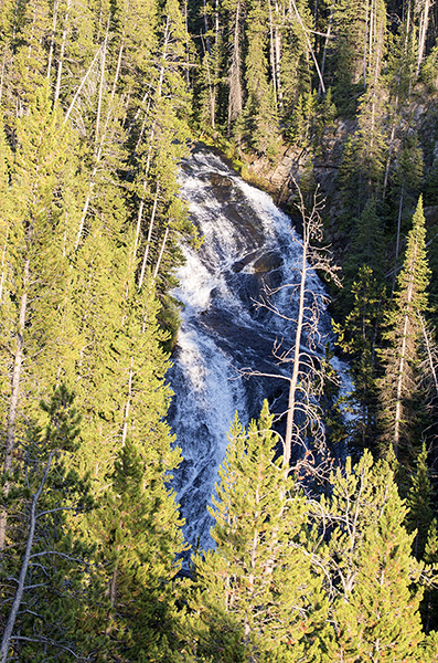
Virginia Cascades
Description
- Type: Cascades
- Height: 60 feet
- Stream: Gibbon River
- Name, origin: “Norris Falls” was first named by P. W. Norris as early as 1880. But in 1886, Ed Lamartine, the foreman of government roadwork, renamed it Virginia Cascade. Named for Virginia Gibson, whose husband Charles became head of the Yellowstone Park Association. To ensure the name’s survival, Lamartine approached Arnold Hague of the U.S. Geological Survey to request the name be permanent. Hague said he didn’t think places should be named for people. But thought it was good to name some features for states. So, in the end, the name was accepted.1
- Hike: No hike required. The drive places you in the only viewable position.
- Location: South side of the Grand Loop Road between Norris Junction and Canyon Junction. Just 2 miles east of Norris Geyser Basin.
Navigate to: Introduction to Falls, Types of Falls or Waterfall Map
Navigate to: Upper Falls or Wraith Falls
1Whittlesey, L. H. (2006). Yellowstone Place Names. Gardiner, MT: Wonderland Publishing Company. Page 260.
