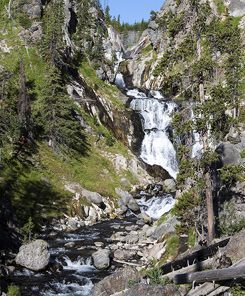
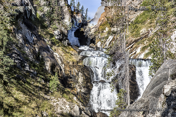
Mystic Falls
Description
- Type: Multi-tiered Cascade/Plunge
- Height: 70 feet
- Stream: Little Firehole River
- Name, origin: Originally named by members of the second Hayden survey “Little Firehole Falls”. But was renamed for an unknown reason to Mystic Falls by members of the Hague parties of the USGS in 1885.1
- Fun Facts: This area isn’t heavily traveled, but you will see some people. Watch for the birds and animals in the area as you walk along the Little Firehole River. Enjoy the peace and tranquility.
- Hike: This is a 2-mile roundtrip hike. The trail is moderately easy. The trailhead is located at the far end of Biscuit Basin.
- Location: You will be hiking from the Biscuit Basin boardwalk, which is 1.8 miles north of Old Faithful or 14.2 miles south of Madison Junction. The basin is on the west side of Grand Loop Road. Until Biscuit Basin reopens, you have to take the path located south of the Biscuit Basin parking lot. It takes you to the back of Biscuit Basin. Do not under any circumstances enter the Biscuit Basin area. It remains an active risk area due to the thermal activity of Black Diamond Pool.
Navigate to: Introduction to Falls, Types of Falls or Waterfall Map
Navigate to: Moose Falls or Rustic Falls
1Whittlesey, L. H. (2006). Yellowstone Place Names. Gardiner, MT: Wonderland Publishing Company. Page 185.